On October 9th, 2024, I woke up feeling like winter was just around the corner, and I knew I needed to make the most of every remaining autumn day. I grabbed some dried fruit, threw on a couple of layers, and set off for the Mt. Margaret Backcountry, just north of Mt. Saint Helens. It had been a few years since I’d tackled the scrambly Whittier Ridge, so Boundary Trail bound it was.
On the south side of the Mount Margaret ridgeline, the Boundary Trail weaves through shrubby scree zones and alpine meadows. To the south, Spirit Lake, Mount Saint Helens, and her crater dominate the horizon. On the north side, the Lakes Trail traverses a series of breathtaking cirques filled with pristine lakes. Clearings along the way offer fantastic vistas of Mount Adams, Mount Rainier, and other scenic mountain chains in the area. This side of the ridge features a lush, riparian valley, with forested paths accompanied by cascading creeks.
Whittier Ridge is a rugged pass that bridges these two trails. On the east end of this trail system lies the Norway Pass Trailhead, while the western access points are the Coldwater Lake or Hummocks/Boundary Trailheads. The Mount Margaret Backcountry is an underrated, under-the-radar area that offers various loops and trails, making it perfect for day hiking, trail running, or backpacking.
Boundary Trail -Whittier Ridge -Lakes Trail return: 27 miles 9,000 elevation gain… this includes a side trip up Coldwater Peak
Starting at the Hummocks/Boundary Trailhead just after 11:00, I headed toward Johnson Ridge Observatory.
Johnston Ridge Observatory
Saint Helens Lake, with The Dome’s prominent pinnacle lording over the golden and rustic autumn meadows, contrasting her deep blue hues.
This hole is the gateway to Saint Helens Lake. I wonder if it has a name?
It stared at The Dome for so long, its shape burned into the rock, revealing Saint Helens Lake and the south ridge of the Mount Margaret Backcountry for the first time.
Saint Helens Lake, with Spirit Lake in the background
Coldwater Peak lives up to its name
Spirit Lake and Mount Saint Helens, her crater residing over the wake of the 1980 eruption
The otherworldly Mount Saint Helens crater rises above a shroud of clouds. In her caldron, baby Saint Helens grows stronger each day.
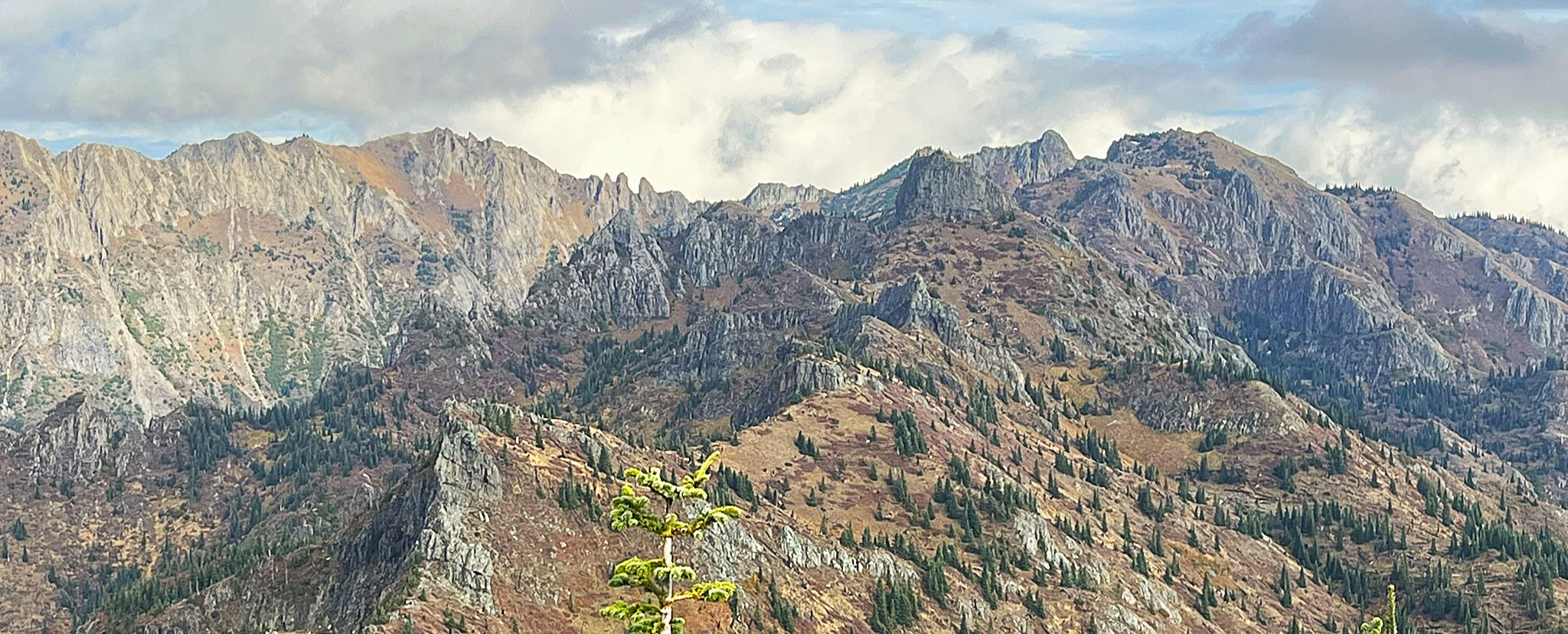
The following 7 rows of images are showcasing Whittier Ridge. Views of it or off it to the lakes and valleys to either side.
This picture is taken from Coldwater Peak, showing the approximate trail route to Mount Margaret. From there, it cuts behind Mount Teragram and the ‘Sentinels,’ eventually following Whittier Ridge for most of the way to Lakes Trail. It’s an unmaintained ridgeline trail with some climbing and steep drop-offs along the way.
Mount Whittier, her head in the clouds, the route guarded by her fanged sentinels.
The taller monolithic sentinel on the left is showcased in the image on the right. I’ll soon be on that snowy path, traversing beneath her cliffs, shrouded in cloud.
A fang of one of the spires stands guard over the precarious path along Whittier Ridge.
The following images highlight the steep vertical terrain along the Whittier Ridge bypass. The center image offers a profile view of the trail shown on the right.
In the distance, the valley I’ll be descending comes into view, framed by the monolithic sentinels guarding Whittier Ridge.
Looking down on Boot Lake. The Lakes Trail runs through the valley just beyond the lake
This, along with the two lake images above, is Shovel Lake. There’s a campground down to the left, where the snow lies—these lakes offer ideal sites for backpackers.
Looking down on Snow Lake with The Dome in the background.
Whittier Ridge rises above on the left, giving way to our fangy sentinel friends marking its end.
Looking up at the Mt Margaret Ridge line across the valley.
Cold Water Lake Valley.
The afterglow on the rock resonates with a tick-tock to the waning light left on my journey.
The fall colors accentuate the rise of Minnie Peak over Coldwater Lake, bringing a striking end to my adventure.